Thursday, 23 July 2020

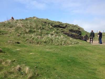
Taversoe Tuick Burial Cairn


Taversoe Tuick cairn was built on the island of Rousay in Orkney. Like the dozens of other contemporary monuments found all across the islands, it was built in the Neolithic Period, around 3300BC, at which time Orkney was home to the most advanced culture in Britain and perhaps Western Europe.

Orkney’s tombs typically have traits in common. They are built overlooking the sea, have a wide view over the surrounding land, but are built into the hillsides so as to be barely distinguishable from the surrounding landscape. They were not built to impress the living who looked up at them, as later Bronze Age tombs were designed. They were built for the eyes of the ancestors to gaze across the land where they once walked and now guarded and reinforced their descendants’ right to live and farm there.

The upper storey of the tomb

Each tomb is also unique, built to a design chosen perhaps intuitively by the community it was to serve. Taversoe Tuick was built on two levels, something found in only one other Orkney tomb. One crawls through the long and low entrance passage to a chamber containing four partitioned areas arranged in an arc, where the disarticulated bones of the deceased were laid. The upper storey is reached by a separate entrance at the back of the tomb and contained two chambers. 
The tomb, discovered and opened in the 19th century, was found to contain cremated human bones, the complete skeleton of an adult, and flint and pottery artefacts. These were perhaps added during the Bronze Age, after the Neolithic Orkney culture had collapsed and its monuments ritually emptied, closed or destroyed.


The rear entrance to the upper storey.

Like many tombs, Taversoe Tuick was built with a view of the sea and its entrance passage aligns to the highest point on the small island of Gairsay to the south, which is marked with a tumulus of possibly Bronze Age date. The Orkney people were sailors, fisher-people and long-distance travellers and the sea was as important to their way of life as the land. It is logical that the ancestor-spirits contained in the tombs guarded the sea-ways as well as the land, and it is easy to imagine a web of guardianship linking between tombs and islands and landmarks the sailors used to guide them home, nourished by the generations of knowledge the people had laboriously acquired. And that web still survives today.


Monday, 22 June 2020

The Knowe of Yarsoe


The Knowe of Yarsoe is a stalled cairn on the island of Rousay in Orkney. Like the majority of the cairns in Orkney, it was built in the early Neolithic period and continued in use for over a thousand years. It stands on the edge of a steep slope which falls away sharply towards the sea, the focus for many Orkney tombs.

Unlike the chambered cairns such as Cuween on Mainland Orkney, the stalled cairns comprise a long, narrow chamber subdivided by stone slabs into sections, resembling cattle stalls, where the bones of the deceased were laid. It is believed the two cairn types represent two distinct but interconnected cultures living in Orkney during the Neolithic period.

This tomb contains four consecutive stalls, and perhaps represents a continuing ritual descent into the spirit world from the earthly world. The innermost stall is partly blocked by stone slabs.


The Knowe of Yarsoe contained the disarticulated remains of around 29 people, dating from 2900-1900BC. All were adults and many more skulls were found than other remains. Orkney tombs typically contained several hundred bodies, adults and children, and many were ritually sealed and/or emptied at the end of the Neolithic period, around 2500BC. The bodies in this tomb may be those associated with the closure rite after the rest of the community’s ancestors were removed elsewhere. 
The dates indicate that these weren’t the last people to die. They may have been especially powerful or revered people whose remains (or perhaps their skulls) had been curated in a tomb or in a house for several hundred years before being placed here, perhaps as guardians of the land or the tomb. Many tombs have legends of ghostly guardians who bring calamity on anyone who disturbs them. Some may have been added long after Orkney’s Neolithic culture had collapsed.


The entrance of the Knowe of Yarsoe faces southeast, along the line of the hillside, on the long axis of the tomb. This is typical of stalled cairns and a major difference to chambered tombs which generally face out to sea. The communities linked to these tombs may have had little affinity to the sea compared with the people who built the chambered cairns.


Red deer. Massimo Catarinella, Wikicommons


Many tombs are linked to specific animals or birds which were interred with the human bodies. These include sea eagles, dogs and otters. The Knowe of Yarsoe contained the remains of at least 34 red deer. Red deer remains are commonly found in stalled cairns but not in chambered cairns, another indication of a cultural divide. The deer was a revered animal, both for its gifts of meat, hide and antler and for its embodiment of the spirit of the wilds. The shedding and regrowth of antlers reflects the dying-and-rising spirit of the green and the deer remained a totem or spirit guide for shamans and ritual specialists throughout the Celtic and Anglo-Saxon periods. The horned God Cernunnos and the sage Merlin were both associated with deer.


Cernunnos on the Gundestrup Cauldron, 1st Century BC. 


Rousay is rugged with steep hillsides and heather moorland, ideal habitat for red deer, which were probably introduced to the islands by people at a very early point in Orkney’s history. Rousay is poor quality land and unsuitable for cultivation, and this offers the idea that the stalled cairns were linked to the earliest hunter-gatherer communities of Orkney, who especially revered the deer, whereas the Neolithic farmers who settled in later times and have proven Middle Eastern ancestry lived on the better quality land more suited to agriculture, built the chambered cairns and the various ritual monuments including the Stones of Stenness and the Ring of Brodgar, and brought Orkney into the forefront of British culture.

Monday, 8 June 2020

The Tomb of the Otters


The Tomb of the Otters is one of the most recently discovered Neolithic cairns in Orkney. It was built on the south coast of the island of South Ronaldsay, a short distance from the Tomb of the Eagles.

Like many of Orkney’s tombs, the Tomb of the Otters is a relatively inconspicuous grassy mound which could easily be a natural feature, as it was supposed to be until chance digging revealed the truth. The tombs were typically blended into the landscape but at the same time offered wide views across the land. They were built for eyes within the tomb, not for the living outside it.


Excavation found it to be a chambered cairn, containing six small chambers leading off from the main chamber. Those at the western end were added after the main construction and another small chamber was inserted under the main entrance passage. The tomb contained over two thousand disarticulated human bones, which had been placed in the tomb over a period of several hundred years.

Some of the bones date to 3300BC, the date of first construction of many Orkney tombs, and genetic analysis shows the dead were settler-farmers whose recent ancestry lay in the Middle East, the birthplace of agriculture. The presence of so many bones is unusual: in many cases, the tombs were emptied at the end of the Neolithic period, around 2500BC, in an elaborate, Orkney-wide destruction and closure of ritual sites.


The coast near the tomb.


 The tombs are believed to each link to one community or village, and many are associated with specific animals or birds which may have been community totems. This tomb is uniquely associated with otters.

The tomb was, uniquely, carved out of the bedrock and is set partly into the ground. This makes it unusually wet inside and the bones were periodically covered with silt, perhaps caused when water levels rose. This was perhaps a deliberate attempt to emulate the otters’ natural habitat.

The skeletons and spraint of otters were found in large amounts inside the tomb, suggesting otters routinely entered it. The skeleton of a four-year-old child was found with a small stone which had been worked to resemble an otter’s head. Perhaps this was a favourite toy, or perhaps a spiritual emblem to help guide this child to the next world.

Many of the ‘totems’ have well-known links to the spiritual world and many are carrion-eaters. The otter almost exclusively eats fish, but has been known to eat carrion. It is possible the otters encouraged in this tomb devoured the flesh of the dead and were considered spirit guides for these people. Their habitat of both land and sea gives them a greater liminal status.

The chambers are roofed with slabs of stone from the beach which are heavily water-worn, creating another deliberate link to the sea.

The majority of Orkney tombs face out to sea, but the entrance passage of this tomb faces north, inland. It is possible this entrance is a later feature after the tomb was extended, perhaps to keep it damp and suitable for otters. The original entrance may have been to the west, where it would face a large lake, plausibly the freshwater home of the otters in question.

  
English Otter. Alexander Leisser, Wikicommons.

Monday, 25 May 2020

The Tomb of the Eagles


The Tomb of the Eagles is a Neolithic chambered cairn in Isbister in South Ronaldsay, the southern-most island of Orkney. Unlike most tombs in Orkney, which were either emptied prior to their closure in ancient times or have been destroyed thanks to time, treasure-hunters or clumsy antiquarians, the Tomb of the Eagles survived intact until its careful excavation in the late 20th century, through which our knowledge of Neolithic Orkney has surged.

The tomb was built around 3150BC, and comprises a stone-built and grass-covered mound which covers a central chamber accessed by a low passage, three metres long, through which visitors have to crawl on their hands and knees. The main chamber contained bodies which were largely intact, perhaps after their excarnation (devouring by carrion-eaters) but before they were deposited with the rest of the ‘ancestors’. It seems the process of death was a long-drawn-out affair in Neolithic Orkney. Side chambers contained unarticulated bones, largely sorted into groups of skulls and other bones. The tomb contained at least 340 people, including men, women, children and babies.


Around 2500BC, the time when bronze started to filter into Britain, the social structure in Orkney collapsed. The tombs which had been used for nearly a thousand years, along with other ritual buildings such as at the Ness of Brodgar, were carefully dismantled or sealed and never used again. The passage of the Isbister cairn was blocked from the inside and the entire tomb was filled with rubble, soil and ancient human bones, perhaps those kept as relics in houses. It was never entered again, although many Bronze Age burial cists nearby indicate the remembered sanctity of the site.


Skulls and round-bottomed Unstan Ware pottery deposited in a side chamber.


Each of the dozens of tombs in Orkney was likely linked to an individual settlement or community, and each seems to have been close-knit and independent. Studies of the skeletons show a high incidence of genetic abnormalities which suggests a large degree of in-breeding. Other Orkney tombs show a different range of abnormalities.

Many are linked to specific and often unique animals or birds which may have totemic links. The Isbister cairn is uniquely associated with sea eagles, which were once common on the high cliffs of the area. Like many of the potential ‘totems’, sea eagles are carrion-eaters and were plausibly used to devour the bodies of the deceased before their interment in the tomb.


Like many Orkney tombs, Isbister opens out across the sea, but the unusual thirty-metre sheer drop is reminiscent of the soaring spirit of the sea eagle.


 A foundation deposit sealed under the flagstone floor comprised bones of humans and sea eagles, dating to 3150BC, and eagle talons were placed with many of the bodies. One had fifteen talons which perhaps formed a necklace. Perhaps eagle-catching was a test of status for the people of Isbister. Scaling the precipitous and sea-lashed cliffs to reach their nesting sites would certainly have tested the physical and mental strength of anybody.

Nearly a thousand years after the tomb was sealed, in 1500BC, a cist grave was inserted in the mound, and this also contained sea eagle bones along with the human remains. Orkney’s status and way of life had changed immensely since the beginning of the Bronze Age, but it seems the people of Isbister had not forgotten their ancient heritage.


White-tailed sea eagle. Jacob Spinks, Wikicommons.

Monday, 11 May 2020

Maes Howe Passage Grave


Maes Howe in Orkney is one of the most elaborate and finely built passage graves known. It was built in the late Neolithic Period, around 2700BC, on a wide, grassy plain a short distance from and in view of the other famous monuments of Neolithic Orkney including the Stones of Stenness, the Ring of Brodgar and the Ness of Brodgar. 

The mound is seven metres high and 35 metres wide – exceptionally large for an Orkney grave – and comprises a passage seven metres long which has to be followed at a crouch to reach a large inner chamber, built of corbelled stone with a phenomenal degree of craftsmanship. The five-metre high ceiling makes it the highest and most impressive Neolithic structure still standing. Three smaller chambers which can only be entered by crawling through their tiny entrances were built on each side. Provision was made to seal each chamber and also seal the main passage from the inside.


 Ward Hill on the island of Hoy 


Unlike other Orkney tombs, with the possible exception of the now-ruined Pierowall on the island of Westray, Maes Howe is aligned to the midwinter sunset which shines down the passage to illuminate the inner chamber. This may explain the unusual height of the passage. Most Orkney tombs have to be entered on one’s belly. The sun from Maes Howe at midwinter sets over Ward Hill on the island of Hoy, the highest point on Orkney, which no doubt explains its location. A standing stone a few hundred metres from Maes Howe also marks the same alignment. This is reminiscent of the much older Newgrange passage grave in Ireland, and there are known links between the two areas in the Neolithic period.


The Barnhouse standing stone and Maes Howe


When Maes Howe was opened by Norse warriors, and later by Victorian antiquaries, no human remains or other relics were recorded. Perhaps they were long destroyed, or perhaps it was never truly a tomb. Its elaborate design and its alignment mark it as separate from other tombs. Its enclosure by a wide and deep ditch, dug as the mound was built and with no causeway across it, is also unique for a passage grave but typical for henge monuments in Orkney and across Britain. It may have been designed as a ‘spirit house’ but in a different way, perhaps absorbing the spirit of the sun to fertilise the womb of the earth.


The interior of Maes Howe, showing the much older standing stones. Islandhopper, Wikicommons.


An earlier structure once stood on the site of the mound, also aligned to the midwinter sunset. This is suggested to have been a house but the importance of its location means it would have been far more than an ordinary dwelling. Four large standing stones were placed in the corners of the inner chamber, offering no structural purpose, and these were likely incorporated from an earlier monument or stone circle, perhaps around the ‘house’ itself, as a memorial or to seed its spiritual essence. Similar stones were used to form the entrance passage. Stone settings at the Stones of Stenness and an elaborate building at the nearby Barnhouse village are aligned to Maes Howe. These both predate the mound so were linking to this earlier structure.

Some of the runic inscriptions. Islandhopper, Wikicommons.


Maes Howe was entered by Norse warriors around 1100AD and it was named as ‘Orkahaugr’ in the 13th century Orkneyinga Saga. Legend says warriors were forced to spend the night in the chamber during a storm and two of them went insane after their ordeal. The spirits of the mound were obviously still potent.

Another Norse legacy is the largest collection of runic inscriptions outside Scandinavia. These mainly comprise men carving their names and making lewd comments about women. Some make reference to a recent discovery of hidden treasure. Elaborate gold and bronze grave goods are associated with a much later time period, so presuming the inscription is not a treasure-hunter’s joke, it may refer to ancient relics such as carved stones, as were found at Newgrange and Pierowall, whose spiritual importance was still recognised. We will probably never know.


The decorated stones once found in the now-ruined Pierowall monument.

Sunday, 26 April 2020

The Bath Springs


The Bath Springs in Somerset are perhaps the longest venerated site in Britain. The three hot springs, which are unique in Britain, were the site of votive offerings since the springs were formed over 10,000 years ago, and their importance continued throughout the Neolithic period and the Iron Age until the Romans constructed their famous temple and baths which form a world heritage site today.


The Roman-built spring pool


The springs are found in a natural bowl between the steep hillsides surrounding Bath, enclosed in a meander of the River Avon. In prehistory, the ground was marshy with several braids of the river flowing through it. The springwater is a constant 42ยบC which would have shrouded the entire area with steam and fog, especially in winter, adding to the magic and liminality of the site. The bitter and sulphurous water has long been associated with healing, and indeed Bladud, the legendary founder of Bath, was said to have discovered the springs after seeing his pigs use the water to cure themselves of skin complaints and subsequently healing himself of leprosy.


Model of the Roman buildings


The King’s Bath Spring, around which the Romans built their temple, is the largest of the three hot springs, and 300,000 gallons of hot water surges from it daily. The Hot Spring and Cross Bath Spring are smaller but were both venerated from prehistory to the Roman period. The Hot Spring is a spa today.

Throughout the Mesolithic period, which dates from 10,000BC-4000BC, worked flint blades and scrapers from many parts of Britain, fossils, hazelnuts, pyrites and probably myriad other organic items which have not survived were deposited in the spring pipes. During the Iron Age, a causeway was built and coins became the favoured offering. Around 70AD, the Romans began three centuries of increasingly elaborate building work.


Some of the Roman votive offerings


The spring was now enclosed into a reservoir which fed into the famous Great Bath, one of the wonders of Britain and the Roman world, an elaborate feat of engineering with a 20-metre vaulted ceiling. A series of smaller baths were used for various health and spa therapies. Windows opened onto the spring pool so the visitors could make their votive offerings. These now included pieces of armour or weapons, bronze and pewter domestic items, horse harness, gems and jewellery, as well as curse tablets invoking divine retribution for thefts or slights.


The temple pediment, showing the male Sul.


A sacrificial altar was built directly north of the spring, in a vast precinct which faced the temple where few people but priests could enter. Bath was sacred to the Celtic deity Sulis or Sul, who was linked to the sun and was equated by the Romans to Minerva, whose bronze and flame-shrouded statue was constantly tended within the temple sanctum. The image of Sul, created by Celtic craftspeople, was displayed on the temple pediment and shows a distinctly masculine face, often erroneously described as a gorgon. The writhing hair and moustache probably represents the sun’s rays. It is unusual, but not impossible, that the Romans associated the site with a female deity of their own. Perhaps they saw water as a distinctly feminine entity which would emasculate their male gods. Interestingly, during rebuilding work two centuries later, new facades showing the Roman Luna and Sol, the sun and the moon, were added to the temple. 


 The bronze head of Minerva, whose statue was tended in the temple.


The Roman sacred site which attracted visitors and pilgrims from across Europe began to decline in the fourth century. The low-lying site was now subject to regular flooding which eventually choked the Roman hypocausts with mud and sand and the baths fell into disuse. Eventually the buildings collapsed or were deliberately destroyed by Christian marauders, and eventually the area reverted to marsh as it had once been, with the exception of pillars of Roman masonry jutting incongruously from the swamp. The springs continued to be venerated for healing purposes into modern history but it was over a thousand years before the true sanctity and history of the site was again discovered.


The altar which was toppled and smashed after the site was abandoned

Monday, 30 March 2020

The River Ure


The Ure near Thornborough


The River Ure in Yorkshire had, along with the Swale, a spiritual and ritual significance equivalent to the Thames and the Stonehenge Avon in southern Britain. Several henges are found on high ground along its valley, many now little more than unexcavated cropmarks. The Thornborough Henges are an exception. Three henges, which possibly represent Orion’s Belt, were dug from gleaming white gypsum and would have been a focal point for a vast distance all around. The Devil’s Arrows standing stones are a little further downstream near the confluence with the Swale.


The central Thornborough Henge


The Ure is sourced in the Yorkshire Dales and flows through the lowlands after it joins with the Swale, where it changes its name to the Ouse, and flows through York and eventually reaches the Humber Estuary, making it one of the most significant rivers of northern Britain. Ure and Ouse may have the same etymological origin.


The Humber Estuary


Rivers were considered sacred in Neolithic and Bronze Age times and this belief survived in various forms until modern times. The River Avon is believed to have formed part of a processional route to Stonehenge, linking the living with the dead or the physical world with the spiritual world. Ritual offerings and the bones and ashes of the dead were deposited in the water, which represented a liminal boundary between worlds. Rivers were the arteries of the land, much like the arteries of the body, and water was a life-giving essence which formed a key part of rituals. The Ure, which means ‘Holy River’ in ancient Celtic, was probably a central part of ritual life to the people of northern Britain, although four thousand years of time has largely eradicated all physical traces of this.


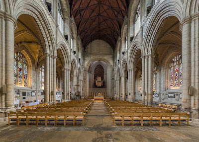
Ripon Cathedral


The spiritual traces however, remain. Several now-ruined abbeys were built along the river’s valley, and the cathedral at Ripon is situated on the banks of the Ure. Ripon has a particularly powerful sense of peace which I never normally feel in an urban environment, and I felt that same powerful essence at every place I visited along the river. I watched a barn owl flying along the banks at twilight and wondered if that was a sign that, just as the river flows on forever, the spiritual qualities it reflects also do the same.


Monday, 16 March 2020

The River Swale


Rivers had special significance in ancient Britain, both for practical reasons such as transport, navigation and water supply, and for spiritual reasons. Water has always been closely linked to the spiritual realms and Neolithic and Bronze Age monuments were commonly built near rivers. Stonehenge, linked to the River Avon, and the monuments on the Thames and its tributaries are famous. The River Swale in northern Britain was once of similar sacred importance, now largely forgotten.


The Swale derives from sualuae, which means ‘deluge’. The river is one of the fastest flowing in Britain and can rise three metres in twenty minutes as rainwater pours off the dales into the valley. Even where the river crosses the gentler lowlands and joins with the Ure, it is still fierce when in spate.


The Swale as it joins the Ure


The importance of the Swale likely links to the Neolithic trade in stone axes. Greenstone axes were crafted in Langdale in the Lake District and transported all across Britain, and had a significance far beyond their practical use. Their route into southern Britain likely followed the River Eden through Cumbria, also the focus of many sacred monuments, and then the River Swale which leads towards the lowlands.


Maiden Castle


The unusual henge of Maiden Castle was built on high ground above the Swale near the village of Grinton in upper Swaledale. Further downstream at Catterick was another henge and timber enclosure, dated to around 2500BC and only recently discovered. The huge standing stones of the Devil’s Arrows are a short distance from the confluence of the Swale with the River Ure. Another interesting place is St Michael’s Church near Downholme, on a unusually shaped and very prominent hill called How Hill. This would have been a key landmark for people following the river millennia before the church was built, and perhaps had also sacred significance long before this point. It is certainly a peaceful and powerful feeling spot today.

St Michael’s Church and How Hill


Monday, 2 March 2020

The Devil’s Arrows


The Devil’s Arrows, also known as the Three Greyhounds or the Three Sisters, are a row of three colossal standing stones near Boroughbridge in Yorkshire. The stones, which reach seven metres in height with another three metres underground, are taller than the sarsens of Stonehenge. They were probably raised in the early Bronze Age, around 2000BC. 
Legend says the devil, sitting on How Hill near Ripon, a strangely prominent and eerie-feeling hill with a ruined church dedicated to St Michael, threw rocks at the town of Aldborough after it offended him. They fell short and formed the Arrows.

The row of Arrows, looking uphill

The three stones are the survivors of a larger row. One stone was pulled down in the 16th century; a fifth one is reputed to have also been removed. Perhaps there were even more, forgotten even by legend. 
The stones, weighing 25 tonnes, are millstone grit, probably originating from a location near Knaresborough, nine miles away. It is possible they were carried by glacial action to a much nearer point, making their transport much easier. The stones were then raised and slid into their sockets, probably using levers and pulleys, and their holes packed with cobbles. It was a phenomenal undertaking. 
The stones were shaped and dressed to give them a smooth finish, something which was rarely done in British stone monuments. The sarsens of Stonehenge are the other best-known example of this, and may suggest this monument was a rival or equal power base to Stonehenge. This area of Yorkshire is believed to have once been equal in importance to the Stonehenge monuments.

The uppermost stone.

The stones are on a 320ยบ alignment, which roughly faces the midwinter sunrise and midsummer sunset, but they are not quite in a straight line. They climb a shallow slope leading from the River Ure – this link to water is reminiscent of Stonehenge – and the final stone sits on the top of the hillside. Perhaps the destroyed stones continued towards the river and the monument formed an elaborate procession up the hillside towards the rising midwinter sun. 
Interestingly, two now vanished henges which stood on shallow hillsides near the village of Hutton to the north, are also on the same alignment as the Arrows. Perhaps it was part of a much greater monumental complex than is currently thought.


The River Ure at Boroughbridge

Monday, 17 February 2020

Old Sarum


Old Sarum is an Iron Age hillfort just north of Salisbury, later adapted into a Norman motte and bailey castle which contained Salisbury’s first cathedral. Salisbury, only a few miles from Stonehenge, has long been considered one of Britain’s most special spiritual places and this stretches back far into prehistory.


The outer bank of the fort.


The fort is on a natural hill which has commanding views over the Avon valley and surrounding area, and draws the eye from miles around. It was an ideal spot for an Iron Age statement of command and power.

The Iron Age ditch and two banks, which enclose an area around 400m diameter, were cleared and redug in Norman times, the reason for their incredible preservation. A visit is recommended just to see how the vast ditches of places such as Avebury and many other hillforts would have looked before thousands of years of erosion and infilling. Standing on the bank and looking into the thirty-metre deep ditch is a vertigo-inducing experience to say the least. It was about more than simple defence. It was a statement of power.


Old Sarum’s ditch. The very small sheep gives an indication of scale. 

Ironically, little more is known of the early site. The Norman reconstruction which preserved the ditches removed everything else. The fort was first built around 400BC, and occupation continued into the Roman period, where it became known as Sorviodunum. Five Roman roads converge at Salisbury which illustrates the site’s importance. Some of these roads were in use long before the Romans arrived, and may even date back to the Neolithic period, which marks the earliest occupation of the site.


The view east from the bank. The Roman road leading towards London is visible.


Salisbury marks the confluence of five rivers, the Avon, Nadder, Bourne, Ebble and Wylye, which would make it a hugely important place in the time when rivers were the main mode of transport and also the most important landmarks when travelling across a land devoid of manmade features. This is likely a big factor in Sarum’s continuing practical and spiritual importance.


The confluence of the Avon and the Nadder.


Sarum was captured from the British by the Saxons and then abandoned until invading Vikings forced its reoccupation. Saxon mercenaries who guarded the junction of the Roman roads lived and were buried nearby, and other rich Saxon burials were found close to the foot of the fort, including that of a sixth-century woman who was buried with elaborate grave goods including a purse ring made of elephant ivory, blue glass beads and a copper brooch. This high-status woman, who had trade links stretching as far as Africa, illustrates the continuing importance of this district, two thousand years after Wessex had become the richest land in Britain.

It is from this period that the name derives. Sarum is an adaptation of Seresberie, a late Saxon-period burgh and Royal Mint. This later evolved into Salisbury. The prefix Sar or Sear is probably a pre-Saxon personal name.


The Medieval castle, cathedral and town.


The fortified town of Old Sarum and its cathedral were later moved south to New Sarum, or Salisbury town, and the ancient site was abandoned to the wilderness.


The view south towards Salisbury. The new cathedral is visible.