Tuesday 29 October 2019

Marden Henge


Marden’s bank, inner ditch and northern entrance.


Marden Henge, about ten miles north of Stonehenge in Wiltshire, is one of the biggest henges in Britain and one of the most unusual. It is in a crook of the Avon, the river which is closely linked to Stonehenge, and the river replaces the bank for part of its perimeter.

The henge, roughly oval and 500 metres across at its widest point, had an entrance aligned precisely north, and a second to the southeast, linked to a causeway which led to the river. Its bank survives up to three metres high and forty metres wide.


The Avon at Marden


The henge was built on the flat river plain where today, after heavy rain, the mud-laden river can be seen creeping around willow trunks and through the long grass on its banks. It probably once filled the henge ditch and waterlogged the surrounding land. Little can be seen of the surrounding landscape beyond the river plain, with the exception of the ridgeline which marks the start of Salisbury Plain, and water seems to be a key aspect of the monument’s character.


The view across the henge towards the river.

The henge has been associated with the construction of Stonehenge. The huge sarsen stones, incorporated into Stonehenge around 2500BC, were dragged from the Marlborough Downs in the north, through the Vale of Pewsey and up onto Salisbury Plain. Recent work has shown that they most likely crossed the Avon at Marden, and were then dragged up the gentle slope which leads from the village onto the high plain, about the only feasible route when dragging multiple twenty-tonne rocks.

Many henges were dug on sites with already sacred or historical importance, perhaps as an act of enclosing and formalising that memory. Marden’s enclosing ditch is dated to 2570-2290BC, the same time or slightly after the sarsens were moved. Perhaps its creation was the final act of Stonehenge’s builders after their work was done.


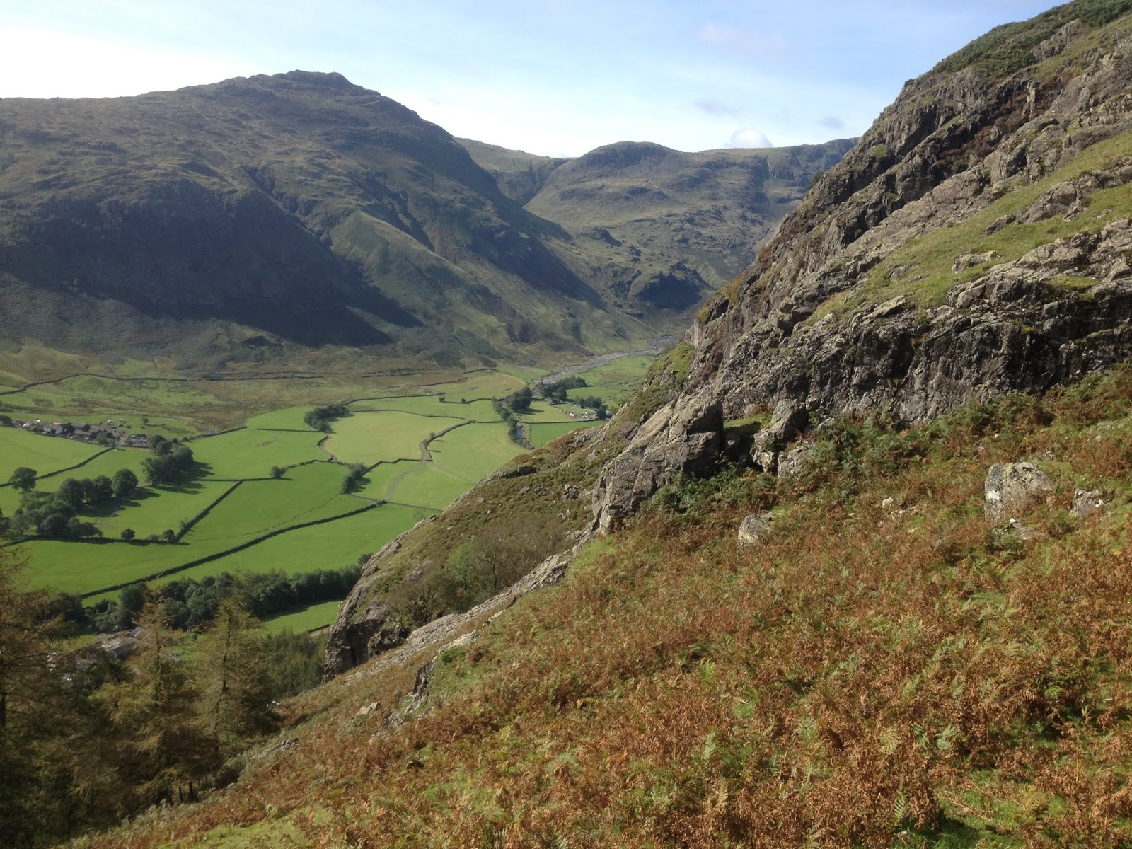
The slope likely used to drag Stonehenge’s sarsens up onto Salisbury Plain


Marden was also the site of a large earthen mound, similar to the much more famous Silbury Hill near Avebury, but on a smaller scale. The mound, 70 metres in diameter and nine metres high, built sometime during or after the henge’s construction, was destroyed after antiquarians dug through it. Nothing now survives. Silbury Hill was built around 2400-2300BC; Marden may have been a similar date.

Both mounds were linked to encircling watercourses, and I feel the idea carries weight that they represent something akin to the mythical island of creation, rising from the primeval waters. It would certainly feel that way, as people watched the water silently creep through grass and tree roots around the mound as heavy rain swelled its course.


Why was it built at Marden? Was Marden linked to the birthpoint of Stonehenge? Perhaps the river was the boundary between two communities, the point where the stones were ceremonially handed over, and so this site was chosen for the great mound to be raised. Unfortunately, thanks to clumsy treasure seekers, we will probably never know.


Wednesday 23 October 2019

Stonehenge


 Stonehenge is Britain’s most famous prehistoric landmark. In its heyday four thousand years ago, it attracted people from across Britain and across Europe. Today, largely ruined thanks to time and human endeavour, nothing has changed.

Stonehenge was built and rebuilt several times over a 1500-year period, in a chalkland landscape which was already of great sacred significance. A series of colossal wooden posts, their significance now long lost, were raised in what is now the Stonehenge carpark 5000 years before the monument was begun. Two linear monuments known as cursuses and several long barrows were built nearby in the preceding centuries. And the spring known as Blick Mead attracted votive offerings for several thousand years.


The Amesbury Archer, who was brought up in the Alps and was buried a mile from Stonehenge around 2400BC. He was perhaps one of the earliest metal workers in Britain.


The earliest construction at Stonehenge was a circular ditch and bank, dug around 3000BC, with a ring of 56 Aubrey Holes around its inner edge. These were once the sockets for the famous bluestones, brought several hundred miles from the Preseli Mountains in South Wales. Many, perhaps all, of the holes also contained cremation burials, perhaps interred as the stones were raised and perhaps of people with particular associations with that stone.

Around 500 years later, the horseshoe of huge trilithons – paired and shaped stones with a horizontal cap – were raised in the centre, along with a circle of capped sarsen stones. The bluestones went through several rearrangements which took place over the next few hundred years. It seems a final rearrangement was abandoned uncompleted around 1500BC.


The approach up the avenue, with one of the ditches still visible. The Heel Stone, a glacial erratic raised in the entrance almost in its natural position, is on the left.


Stonehenge seems to have been a place linked to death and funerary rites. The remains of over 150 people were interred at the site, and no evidence of feasting or other signs of occupation have been found. As is perhaps fitting with its unique structure, people came here only for important and austere rites.

Stonehenge was approached along an avenue, over 3km long and 22 metres wide, which led from the river Avon in a circuitous route to cross King Barrow Ridge, later the location of several Bronze Age barrows, and the first view of the stones in the distance. They are in fact barely noticeable, lost among the grey-green of Salisbury Plain, and soon vanish from view as one drops into the valley of Stonehenge Bottom, probably once a seasonal watercourse.

Then comes the climb up the hillside, and the stones gradually rise from the ground and stand proud on the skyline, displayed in all their glory as the walker approaches. The world beyond them remains invisible. It is a remarkable piece of landscape engineering, which would have been all the more powerful with the banks of the avenue funnelling the viewer’s attention.


The view from the entrance.


The stones seem very distant from the outer ditch, today’s permitted viewing point, and this was probably intentional to reinforce the point that only the select few were permitted into the stones’ presence. The ten-metre high trilithons crowding over the initiate would create a near terrifying sense of claustrophobia and power. It would feel like the most powerful place in Britain, in the world, as it was intended.


The Stonehenge Archer, buried in the ditch around 2200BC. He had died after being shot by three arrows which broke his sternum and one rib, shown in the picture. Was this a murder or a sacrifice?


The avenue and entrance align to the midsummer sunrise and the midwinter sunset, and recent investigation has shown that beneath the avenue lay several periglacial channels, deep ditches naturally formed during the Ice Age and by coincidence on exactly the same solstice alignment. These were incorporated by the avenue’s builders. Were they seen as a natural sun channel, created by the Gods, spirits or ancestors, and eventually incorporated into Britain’s most important sacred site? It seems very likely.


One of the many Bronze Age barrows which focus on Stonehenge.


Stonehenge’s final modification was during the mid Bronze Age, around 1500BC, but it was the focus of attention, good and bad, long after this point. Bronze Age barrows were raised where they would be visible on the skyline from Stonehenge. Roman-era pottery was found in large quantities, perhaps the result of religious rituals. It seems some of the stones were toppled by the Romans, perhaps an attempt to break the site’s power. In the Saxon period, when the site became known as the ‘Stone Hangings’, it was used for executions.

Today, it is a tourist attraction.

Monday 7 October 2019

The Langdale Axe Factories


The hillsides around a few remote valleys in the Lake District became the hub of activity in the Neolithic period, attracting people from across Britain to quarry stone to make polished axes.

The crags around Langdale, a few miles west of Lake Windermere, contain a natural band of volcanic tuff or hornstone, a deep green rock which was greatly prized by the Neolithic people. This hornstone is found from Stickle Tarn, a mountain lake high above Langdale, through the Langdale Pikes to the west to Scafell Pike, England’s highest mountain, and then petering out further north.


The stone can be found in streambeds and dug from pits on the level heights, but the Neolithic people went to great effort to quarry stone from the most dangerous and inaccessible rockfaces they could. They climbed the precarious crags, balanced on narrow and unstable ledges a dizzying distance above the valley floor, and hewed blocks of stone from the rockface, often using fire to fracture the rock. The almost ubiquitous rain and fog of the area made the stone dangerously slippery and the climb up and down near impossible. The stone was gained at a high price.


The stone was flaked like flint into a roughout axe at the quarry site, and when the maker was happy they had drawn the essence of an axe from the raw stone, they returned to the lowland areas where hours of painstaking polishing and grinding removed all ridges and imperfections and the perfect shine of the greenstone remained. The axe was finished.


The importance of the axe went far beyond its practical function. The deliberate and unnecessary danger the axe makers underwent suggests that the spiritual power of the crags, the willing trial which would end either in a messy death or the mastery of death, suggests an initiation into the brutal powers of the mountains, and that power infused into the finished product, giving it a highly prized power or prestige. Magical objects such as the Norse God Thor’s hammer likely have their origin as a stone axe.

Many of the stone circles and henges in Cumbria, including Castlerigg by Keswick, Grey Croft on the western coast, Long Meg and her Daughters in the Eden Valley, and Mayburgh Henge near Penrith are linked to the trade of axes and the control of access to the quarry sites, which were worked for over 1500 years.

                                A freshly broken rockface, showing the prized green stone.


Langdale axes were prized and have been found across Britain as far as Etton, a Neolithic causewayed enclosure near Peterborough, Stanton Harcourt, a monumental complex on the River Thames, and Llandegai, a vast but now destroyed henge complex in north Wales. It’s telling that all these were ritually deposited in sacred places at the end of their life. Axes made from local stone for mundane purposes such as chopping firewood didn’t receive such treatment.

                       Harrison Stickle, one of the most well-used quarry sites.


During the Bronze Age, the symbolic power of the stone axe declined, and the Langdale quarries were slowly abandoned. Those polished axes which were later discovered took on a new purpose. They were believed to be lightning bolts, and were used to ward off lightning, were placed in water troughs to give healthy livestock, and many other protective purposes. The magic of these once sacred objects never really died.