Showing posts with label Lake District. Show all posts

Monday, 7 October 2019

The Langdale Axe Factories


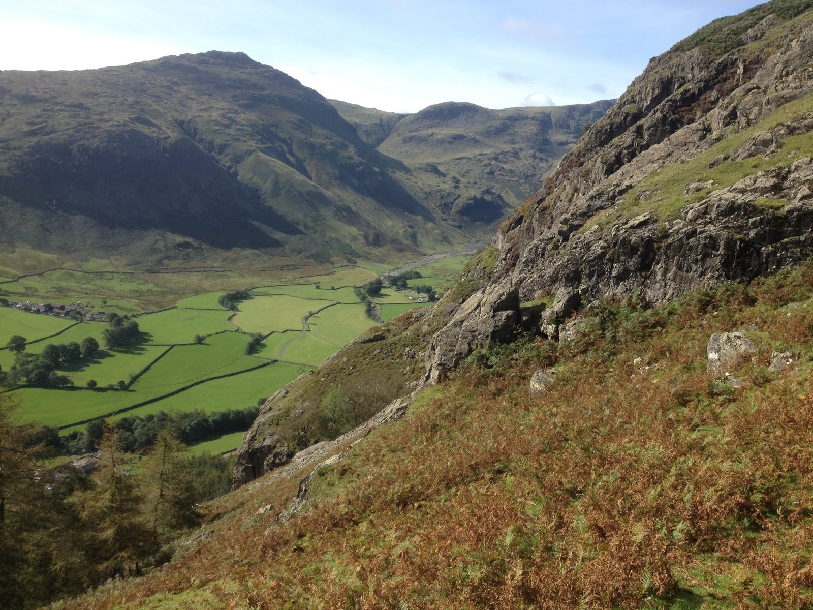
The hillsides around a few remote valleys in the Lake District became the hub of activity in the Neolithic period, attracting people from across Britain to quarry stone to make polished axes.

The crags around Langdale, a few miles west of Lake Windermere, contain a natural band of volcanic tuff or hornstone, a deep green rock which was greatly prized by the Neolithic people. This hornstone is found from Stickle Tarn, a mountain lake high above Langdale, through the Langdale Pikes to the west to Scafell Pike, England’s highest mountain, and then petering out further north.


The stone can be found in streambeds and dug from pits on the level heights, but the Neolithic people went to great effort to quarry stone from the most dangerous and inaccessible rockfaces they could. They climbed the precarious crags, balanced on narrow and unstable ledges a dizzying distance above the valley floor, and hewed blocks of stone from the rockface, often using fire to fracture the rock. The almost ubiquitous rain and fog of the area made the stone dangerously slippery and the climb up and down near impossible. The stone was gained at a high price.


The stone was flaked like flint into a roughout axe at the quarry site, and when the maker was happy they had drawn the essence of an axe from the raw stone, they returned to the lowland areas where hours of painstaking polishing and grinding removed all ridges and imperfections and the perfect shine of the greenstone remained. The axe was finished.


The importance of the axe went far beyond its practical function. The deliberate and unnecessary danger the axe makers underwent suggests that the spiritual power of the crags, the willing trial which would end either in a messy death or the mastery of death, suggests an initiation into the brutal powers of the mountains, and that power infused into the finished product, giving it a highly prized power or prestige. Magical objects such as the Norse God Thor’s hammer likely have their origin as a stone axe.

Many of the stone circles and henges in Cumbria, including Castlerigg by Keswick, Grey Croft on the western coast, Long Meg and her Daughters in the Eden Valley, and Mayburgh Henge near Penrith are linked to the trade of axes and the control of access to the quarry sites, which were worked for over 1500 years.

                                A freshly broken rockface, showing the prized green stone.


Langdale axes were prized and have been found across Britain as far as Etton, a Neolithic causewayed enclosure near Peterborough, Stanton Harcourt, a monumental complex on the River Thames, and Llandegai, a vast but now destroyed henge complex in north Wales. It’s telling that all these were ritually deposited in sacred places at the end of their life. Axes made from local stone for mundane purposes such as chopping firewood didn’t receive such treatment.

                       Harrison Stickle, one of the most well-used quarry sites.


During the Bronze Age, the symbolic power of the stone axe declined, and the Langdale quarries were slowly abandoned. Those polished axes which were later discovered took on a new purpose. They were believed to be lightning bolts, and were used to ward off lightning, were placed in water troughs to give healthy livestock, and many other protective purposes. The magic of these once sacred objects never really died.

Monday, 30 September 2019

Castlerigg Stone Circle


Castlerigg stone circle lies on the eastern edge of the Lake District near the town of Keswick. Its name derives from Carsles or Carles, a name recorded in the 18th century and deriving from the French carole, meaning a circular dance. It's interesting how many stone circles are linked to dancing. It was built around 3200BC, making it one of the earliest stone circles in Britain.

The circle is 30 metres in diameter and originally comprised 42 stones, of which 38 remain. The stones are glacial erratics, probably from fairly close by, and most are 1-1.2 metres in height. Two taller stones flank the north-facing entrance, and an offset pillar to the southeast, almost 2 metres tall, aligns to the sunrise at Samhain (1st November) and Imbolc (1st February).

A rectangular setting of about twelve smaller stones stands in the eastern part of the circle and focuses on the prominent hill of Clough Head on the skyline.

Another standing stone is found near the western edge of the site. Its original location is now unclear but it may have come from the circle itself or was perhaps another outlier stone.


          The internal rectangular setting


Castlerigg is sited on an area of gently sloping higher ground, surrounded by the settled areas and farmland that have long filled the lowlands of the area. The ring of stark mountains and fells beyond provides a contrasting backdrop and reflects the varied topology and spirit of the Lake District. Thanks to the slope of the ground, fairly little of the immediate area is visible from the circle, and conversely, the circle was perhaps equally hidden until the final approach up the hillside. This would have added an air of magic to the site.


           The outlier stone which is angled towards the Samhain sunrise


Castlerigg, like Mayburgh Henge 15 miles to the east, is linked to the manufacture and trade of polished stone axes which were made from green volcanic tuff found in a few isolated and inaccessible hillsides deep in the Lake District mountains. Three of these axes and an unpolished roughout have been found inside the circle.

The north-facing entrance faces what is now the main road from Penrith to Keswick and what has probably always been the major route into the Lakes. From the circle, the main view is the wide valley to the southeast which leads to the villages of Grasmere and Ambleside and then to the Langdale valley where the axe quarries were accessed. Castlerigg was certainly there to oversee the routeways used by the special greenstone and the people who worked it.


Monday, 23 September 2019

Mayburgh Henge


Mayburgh Henge, near Penrith on the edge of the Lake District, is a stunning monument. It was built in the late Neolithic period and comprises a circular bank of stone, 50 metres wide at its base, 120 metres in diameter, and surviving to a height of 6 metres. It’s estimated to contain 20,000 tonnes of stone, probably carried up from the river Lowther, although it has also been suggested it was reshaped from a natural glacial deposit.


            Mayburgh Henge from the south


The henge is on a knoll of high ground which gives it a natural dominance over the surrounding area, and it would have been clearly visible from the surrounding fells before the grass began to cover it. It’s sited above the confluence of the rivers Eamont and Lowther, and above the ancient lowland routeway to the north and south, which forded the rivers at this point. Mayburgh was probably associated with the trade of stone axes, which were ground from Lake District greenstone and traded across Britain as far as East Anglia.


        The river Lowther, from which Mayburgh’s stones may have been carried.


The bank’s position and height make it impossible to see inside the henge, even from the distant fells, except for a tantalising view of its standing stones visible through the entrance from several hundred metres away down the hillside. This would have enhanced the mystery and power of the site for those who travelled by. It gives the impression of a powerful site and powerful people, a fitting guardian for the entrance into the hostile mountains where the stone quarries were found.


          The view from the entrance. The trees give an indication of size.


Four standing stones were raised in a square in the centre of the circle, of which one survives. Four more were present in the entrance, which faces due east. The stones were destroyed in the 18th century, after which one of the workmen went insane and another committed suicide. Damaging once sacred monuments always seems to have a bitter price.


 The remaining standing stone, approximately 3 metres high.


Two other smaller henges were situated along the river Lowther, a few hundred metres away. King Arthur’s Round Table is 90 metres in diameter and comprises a circular ditch with an outer earthen bank. Two entrances lay to the south-east and north-west. The latter, which was flanked with two standing stones, has been destroyed, but would have aligned directly to the entrance of Mayburgh Henge, much further up the hillside. The second henge, the Little Round Table, was a similar size and has been entirely destroyed.

Both these henges lack the feeling of dominance and power of Mayburgh, and were perhaps used for more mundane work or trade, with only a select few being allowed up the hillside into the hidden inner sanctum of the greater henge, which still feels powerful after five thousand years.


             King Arthur’s Round Table