Monday, 27 May 2019

Cuween Chambered Tomb


This is a tomb near Kirkwall on the north coast of Mainland Orkney, built by Neolithic farmers around 3000BC.

Dozens of tombs were built around Orkney and each was probably linked to a small community who farmed the immediate area. There was a small Neolithic settlement at the foot of Cuween Hill. Unlike the chambered tombs of southern Britain such as Belas Knap and Wayland's Smithy, Orkney’s tombs were often in use for a thousand or more years and may contain several hundred bodies.

Cuween comprises five dark, damp chambers leading out from a central chamber. This is reached by a long, low passage entered at a crawl. Some of the chambers are level with the central chamber; others are raised; others have a flagstone divider. The arrangement seems entirely organic with no overall grand design. This is the case with many of the tombs, which each have a unique layout. Perhaps the builders worked entirely through intuition or with the help of spirit guides who, while in a trance state, ‘drew’ the tomb into this world.

Cuween was excavated a century ago and was found to contain the bones of eight people and 24 dog skulls. The small number of human bones suggests the tomb was periodically cleared of bones, or perhaps emptied at the end of its use-life. The presence of dogs is unique, although other tombs contained animal bones such as red deer, otters or sea eagles, and may indicate a community totem or spirit guide. Dogs are commonly seen as guardians of the underworld or as guides for the dead. The dogs were collie-sized and resembled a grey wolf.


The view from the cairn across the farmland and the sea


Cuween probably derives from ‘kewing’, meaning cattle pasture. Due to the short growing season at this northern latitude, cattle have always formed the basis of Orkney’s agriculture. In more recent folklore it was known as the Fairy Knowe.

The tomb was cut out of the bedrock and roofed with flagstones then covered with earth. From a distance it blends into the hillside in this respect resembles the southern tombs. Its purpose was to form a bond with the land, and its influence spread over the farmland below it.

Most of the Orkney tombs face out to sea. The sea was a provider and nurturer as much as the land, and it makes sense for the guardian influence of the ancestors to extend across the water. It may also reflect the journey of the souls of the deceased.

Like many of the tombs, Cuween had been carefully sealed up. This generally seems to have happened around 2500BC, when Orkney’s Neolithic culture dramatically ended. The tombs gradually became the haunt of fairies and ghosts, left undisturbed for fear of violent repercussions from angry ghosts.

Monday, 20 May 2019

Belas Knap long barrow


Belas Knap is a long barrow near Winchcombe in Gloucestershire. It was built in the early Neolithic period and is of similar style to dozens of other barrows found across the Cotswolds and the Severn valley.

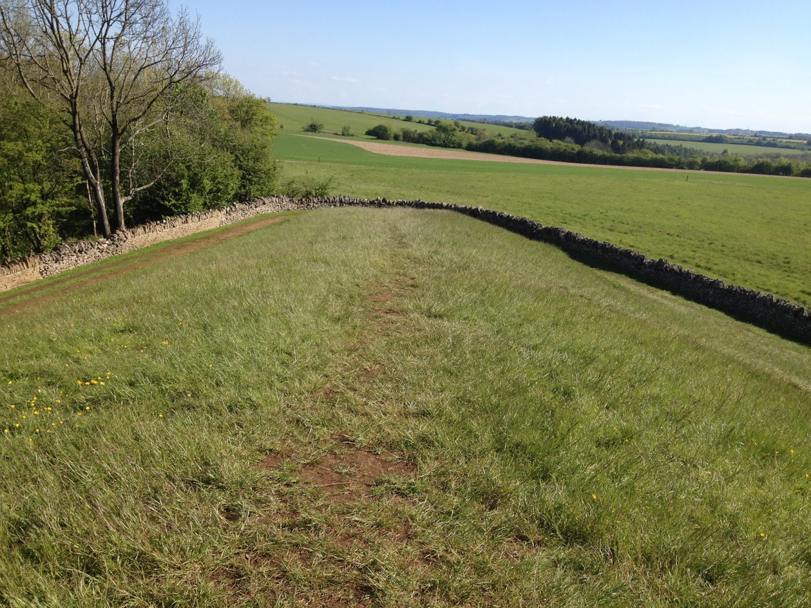
The barrow is situated on a wide, rolling hillside, with a wide view in three directions and a steep, wooded scarp dropping sharply on the eastern side. This was probably wooded in the Neolithic period and so would have obscured the only prominent view of the barrow. From all other directions, the barrow quickly blends into the ground. Like Wayland's Smithy long barrow, Belas Knap was not intended to be a visible statement, but conversely the barrow itself has a sweeping view of the landscape. They seem to be about blending with the earth, returning the ancestors and their skills to the earth, as well as legitimising their continuing presence on this tract of land. They reflect heritage and belonging.


            Belas Knap from the east.


                View south from the barrow.


The barrow is aligned to the north. This is unusual: most long barrows face roughly east. Four burial chambers were set into its length and the main forecourt with its stone façade was actually a false entrance. It’s believed the chambers were built separately as individual burial mounds, then later incorporated into a huge barrow. Many barrows including Wayland’s Smithy were originally smaller structures which were extended into huge mounds a century or two later. Even earlier than the chambers was a circular arrangement of stones lying near the centre of the current mound.

The barrow was crudely excavated in the 19th century and restored to its current condition in the 1920s. It was originally 60m long and 25m wide but its edges have now been trimmed due to erosion, agriculture and excavation. Thirty eight bodies were found, dating from 3700BC-3600BC.

Behind the slabs of the false entrance were the bones of one man and five children, along with flints and horse and pig bones. The western side chamber, lined with sarsens and drystone walling, contained fourteen bodies including a woman with fatal head injuries. The southern chamber, now almost entirely destroyed, contained one body. The south-eastern chamber, which is much lower and has to be entered on one’s belly, contained four bodies. The north-eastern chamber which is lined with sarsens contained twelve bodies.

The chambers were repeatedly visited and opened and sealed, probably used for rites such as marriage, blessing the land and blessing births as well as for burial. Then, like many long barrows, the chambers were eventually sealed for good. This often seems to coincide with the arrival of bronze in Britain around 2500BC.


                  The north-east chamber.


Barrows were often respected for millennia after their closure, although their stones crumbled and collapsed and trees and shrubs obscured them. Belas Knap means ‘beautiful hilltop’. As this seems to refer to the barrow itself rather than the hillside, it is perhaps a name of uneasy respect given by later, more superstitious people to a haunted and feared place. Many ancient sites were avoided as haunts of fairies or dwarfs, later still the work of the devil. This may derive from people unwittingly uncovering the bones of long-dead people, or perhaps it is a long-remembered folk memory of the fearful rites once conducted here.

Monday, 13 May 2019

Lydney Roman Temple


This Roman temple is on a precipitous hill in Lydney in Gloucestershire, overlooking the western bank of the River Severn. Rivers were Britain’s arteries in both a material and spiritual sense, and this site, overlooking the waters which dominate the view today and would have been even more spectacular in historic times when the river was a lot closer, was of strategic importance until the Medieval period.


The view from the Iron Age embankment towards the Roman site, with the River Severn in the distance.


The Roman buildings were built on the remains of an Iron Age hill fort, the latter dating to around 100BC. Both Celts and Romans extensively mined the hill for iron ore until the elaborate temple complex was built around 360AD. Its Roman name was Nemetobala, meaning ‘hill sanctuary’.

The temple was dedicated to Nodens, a Celtic God associated with healing, hunting, the river and fishing. Nodens has no other mention in the ancient world. This is probably unsurprising as in Celtic culture, as well as many other cultures worldwide, the true names of revered beings were rarely known and almost never spoken. Disguised names abounded.

Nodens has been linked to the Irish Nuada and the Welsh Lludd, and was probably associated with the healing God Asclepius by the Romans who respected and assimilated many foreign deities into their culture. Asclepius likely means ‘dog-man’, and several plaques and figurines of dogs have been found in the temple. Dogs were often kept in temples and would lick wounds to aid healing. This would have worked: enzymes in saliva are strongly antibacterial.


                           The Roman baths.


Near the temple was a bath house, probably for ritual use, and a long building comprising a series of rooms probably used as dormitories, dreams being powerful and prophetic and interpreted onsite by diviners. A mansio or guest house illustrates the importance of this site which attracted wealthy pilgrims from far and wide.

The temple was in use long after the collapse of the Roman Empire, after which the Iron Age ramparts were repaired and extended. Sometime during the 5th or 6th century, it was burned down and the roof and walls collapsed inwards, preserving its elaborate votive offerings and mosaic floors for posterity.

The remains of the ancient buildings remained visible for centuries and like many Roman sites the hill, now known as Dwarf Hill, was avoided as the haunt of fairies or dwarfs.

Monday, 6 May 2019

Old Bewick Hillfort


The escarpment which flanks the hillfort, looking across the vale to the Cheviot Hills.


Old Bewick Hillfort is on a steep hill near the Cheviot Hills in Northumberland. It comprises two stone-walled structures of circular banks and ditches, side by side, built against the steep hillside to the south. Little remains of them today but they can easily be seen as circles of green and brown. Bracken is very fussy about growing on the remnants of historic sites, and these patterns are often the first clue to their presence. Several hut circles can be seen.

It is described as a fort but was a relatively small settlement, perhaps for one or two families, although the effort needed to create the walls and ditches perhaps suggests another purpose. It may have had religious significance.

The fort dates to the Iron Age but the site was of significance long before this time. Several Bronze Age cairns were built nearby, and excavation has revealed pottery urns, a necklace of jet and shale, and another necklace of amber. These were prestigious items and suggests the graves of wealthy or important people. The site was venerated long after the Bronze Age.


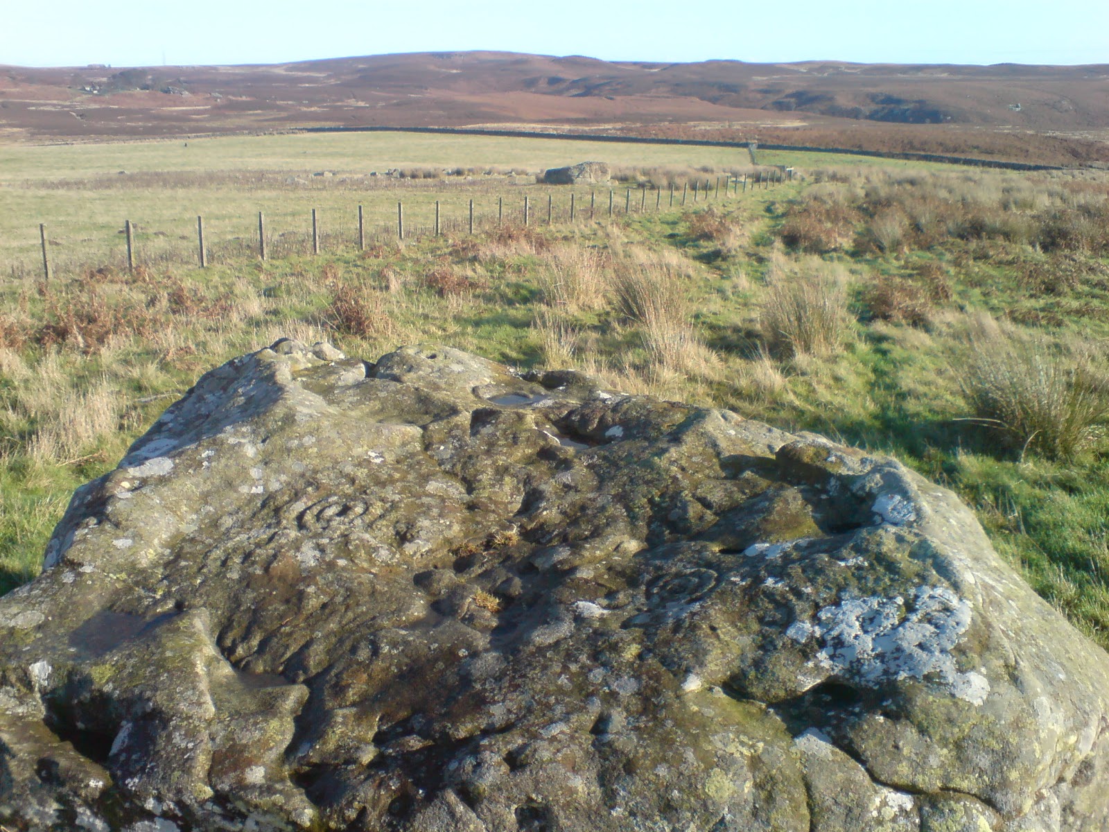
Cup-and-ring marked rock, prominent in the moorland.


The site is also significant for its cup-and-ring marked rocks. Northumberland is famous for these stones, which are found on many hillsides with substantial views, and those at Old Bewick were the first to be recognised as of ancient origin, rather than the work of an idle shepherd. They are thought to originate in the late Neolithic or early Bronze Age.

They resemble art found in Neolithic passage graves such as Newgrange in Ireland and Pierrowall in Orkney, and engraved slabs have also been found in Bronze Age burials in Northumberland.

Each carving is unique and uses the contours of the rock to enhance its art. They are certainly of great symbolic importance, but their meaning remains entirely unclear.


Monday, 29 April 2019

The Ring of Brodgar


The Ring of Brodgar in Orkney is one of the largest stone circles in Britain. It sits on a narrow peninsula between the two vast Lochs of Harray and Stenness, a balance point between land, sea and air. The waters, usually turbulent with the wind and reflecting the grey, scudding clouds which race from the nearby sea, eventually touch the hills which frame this panoramic scene, and reinforce the impression that this peninsula is the centre of Orkney’s landscape. It has been described as a natural amphitheatre, and it is easy to imagine dozens of people on the hilltops, looking down at this stone circle and watching rites whose effects would ripple out to touch them all.

The Ring is flanked by the nearby The Stones of Stenness to the south, possibly the oldest stone circle in Britain, and the Ring of Bookan to the north, a possible henge now all but destroyed. Its two entrances focus on these sites.

It has been suggested that the layout of the three monuments reflect the three stars of Orion’s Belt. It is a convincing match, and may explain why the Ring of Brodgar is slightly off-centre on the sloping hillside, but my feeling is too much effort is made to link sacred sites to the stars. Most seem to me to be orientated to and blended with the surrounding landscape, which enhances the idea that they reflect a spiritual microcosm of the land where rites could be conducted to influence that land.

The Brodgar stones originate from various sites across Orkney, creating the evocative image of a blending of communities and their spirits into a single monument in the heart of the land. The circle is 104m in diameter and comprised sixty stones, of which thirty six remain, surrounded by a six-metre wide ditch. It was built around 2500BC, shortly before the collapse of Orkney’s highly advanced Neolithic culture. It was perhaps a last attempt to save it, or a lasting memorial to its existence.


The Comet Stone, an outlier of the Ring of Brodgar. Two other broken stones lie nearby. Legend says the stone was a piper, turned to stone along with the dancing giants.

Like many stone circles, legend states the Ring of Brodgar was formed when a group of dancing giants were turned to stone after failing to notice the approaching sunrise. I wonder if these stories reflect their former use for shamanic or ritual dances.

The two stone circles were known to locals as the Temples of the Sun and the Moon, and betrothed couples once prayed inside them to Woden to seal their relationship. This is likely a relic of Orkney’s Nordic heritage, and continued almost to living memory.

The Ring of Brodgar was built to guide the Orkney people’s lives. People have long memories. Five thousand years later, that spirit still survives.

Monday, 15 April 2019

Edgehill Battlefield


The annual re-enactment of the battle of Edgehill.


Relations between King Charles I and his parliament had fractured. In August 1642, the King raised his standard and civil war began. The first major battle took place at Edgehill in Warwickshire on 23rd October, each side comprising 15,000 foot soldiers and cavalry armed with muskets, pikes and cannons.

The battle began at 3 o’clock. The royal army advanced and a cavalry charge smashed the parliamentary cavalry, but the parliament’s foot soldiers held firm, exhorted by their pastors to fight for God’s right, and the battle descended into confusion and slaughter until nightfall, when ammunition and powder ran out and darkness made fighting impossible.

The next day, both armies withdrew. Neither side had won a conclusive victory, and both had suffered terrible losses. Over 1500 dead men were scattered across the battlefield; many more were injured or maimed.

The result was the war dragged on for several years, ravaging the English countryside and causing intolerable hardship for soldiers and civilians alike, until the king was finally defeated and executed.


Little can be seen of the famous battlefield today. Time and nature have consigned the slaughter to a long-obscured memory. But the unprecedented battle lingers in the local landscape, perhaps in more than one way.

The first account of apparitions re-enacting the battle appeared in January 1643. “Strange and portentous apparitions of two jarring and contrary armies… heard by shepherds and countrymen and travellers, first the sound of drums afar off, then the noise of soldiers giving their last groans. Then appeared in the air the incorporeal soldiers that made those clamours, ensigns displayed, drums beating, muskets going off, horses neighing… after three hours’ fight the army carrying the king’s colours appeared to fly, the other remaining masters of the field.”

Subsequent visitors to the battlefield identified among the apparitions key noblemen who had died in the battle including Sir Edmund Verney, the king’s standard bearer.

The apparitions eventually ceased, but still appear on occasion, most commonly the anniversary of the battle. And the battle is still annually re-enacted by the Sealed Knot.


Red Road in Kineton, said to have run red with blood after the slaughter 400 years ago.

Monday, 8 April 2019

The Stones of Stenness


The Stones of Stenness. The curiously sloping stones result from the natural fracture lines in the rock. The popular idea that they recreate the sloping peaks of Hoy in the distance, I feel is coincidence.


This stone circle in Orkney, built around 3100BC, is possibly the oldest in Britain. It is at the heart of a vast and complex ritual site on the Brodgar peninsula which would eventually comprise two stone circles, a series of earthen mounds and some of the most elaborate stone buildings of Neolithic Europe.

The circle once comprised twelve stones, of which four remain, the tallest nearly six metres in height. They were erected inside a circular ditch and bank which has now almost entirely vanished. The ditch was once two metres deep and seven metres wide, a vast construction effort considering it was cut through bedrock using only stone and antler tools.

The site is on a low-lying peninsula between the two huge lochs of mainland Orkney, the Lochs of Stenness and Harray. Beyond the lochs, hills rise in the distance and the dramatic peaks of the island of Hoy lie to the south.

The entrance faces due north, across the Loch of Harray and towards the distant hills. An interesting observation is that the surrounding hills and valleys from this point are almost symmetrical. This apparent balance may be the reason for the circle’s location.

The circle was used for feasting and hearth stones still survive in the centre. Pottery and animal bones have been excavated. Perhaps it was a gathering place, a microcosm of land surrounded by water, reflecting every island in Orkney and also perhaps the world in general and the spiritual world. A world surrounded by water which must be crossed to reach the spiritual world is a recurring theme in myths worldwide. That the stones seem to have been brought from various places in Orkney supports this notion.

The circle also contained other stone features. These were once presumed to be altar stones for human sacrifice and re-erected as such, and now their original arrangement is long lost. Other wooden features also stood on the site, perhaps much older than the stone circle itself. It is a common occurrence across Britain for wooden structures, perhaps temples or ‘spirit-houses’, to be later memorialised in stone.


The Stones retained their importance long after the Neolithic period ended. Burial mounds were arranged around the stones and the surrounding area into the Bronze Age, and into the 19th century local couples would pray to Odin – perhaps a throwback to Orkney’s Nordic heritage – inside the stones, now locally known as the Temple of the Moon, for a successful marriage. And today, they form part of a World Heritage Site which attracts visitors from across the world.